
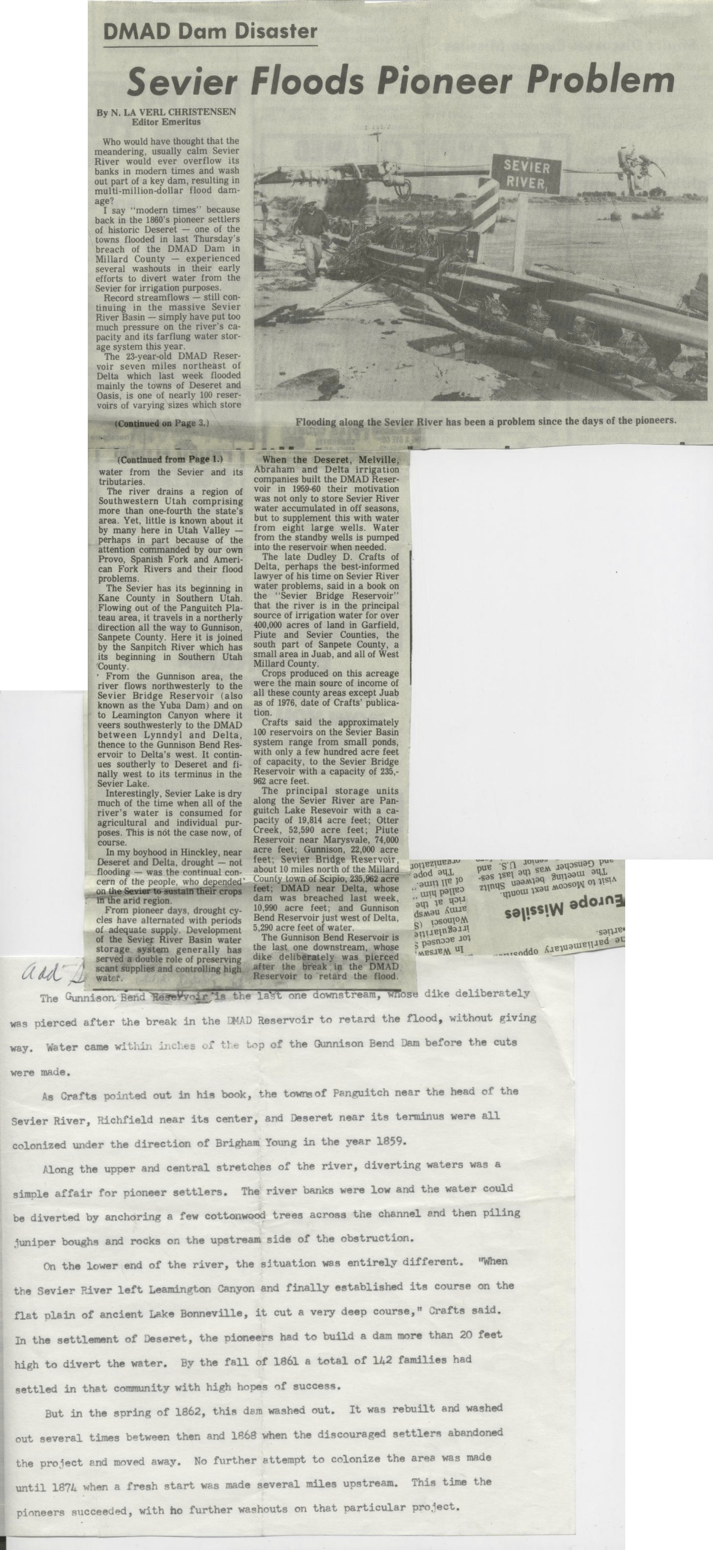
 Who would have thought that the meandering, usually calm Sevier River would ever overflow its banks in modern times and wash out part of a key dam. resulting in multi-million-dollar flood damage? 1 say “modern times” because back in the 1800’s pioneer settlers of historic Deseret – one of the towns flooded nn last ‘1’hursday’s breach of the DMAD Dam in Millard County – experienced several washouts in their early efforts to divert water from the Sevier for irrigation purposes. Record streamflows – still continui in the massive Sevier RiverIflgasin – simply have put too much pressure on the river’s capacity and its farflung water storage system this year. The 23-year-old DMAD Reservoir seven miles northeast of Delta which last week flooded mainly the towns of Deseret and Oasis, is one of nearly 100 reservoirs of varying sizes which store water from the Sevier and its tributaries. ‘fhe river drains a region of Southwestern Utah comprising more than one-fourth the state’s arm. Yet, little is known about it by many here in Utah Valley perhaps in part because of the attention commanded by our own Provo, Spanish Fork and American Fork Rivers and their flood problems. The Sevier has its beginning in Kane County in Southern Utah. Flowing out of the Panguitch Plateau area. it travels in a northerly direction all the way to Gunnison, Sanpete County. Here it is joined by the Sanpitch River which has its beginning in Southern Utah ‘County. ‘ From the Gunnison area, the river flows northwesterly to the Sevier Bridge Reservoir (also known as the Yuba Dam) and on to Leamington Canyon where it veera southwesterly to the DMAD between Lynndyl and Delta, thence to the Gunnison Bend Reservoir to Delta’s west. It continues southerly to Deseret and finally west to its terminus in the Sevier Lake. Interestingly, Sevier Lake is dry much of the time when all of the river’s water is consumed for agricultural and individual purpose. This is not the case now, of course. In my boyhood in Hinckley, near Dean-et and Delta, drought – not flooding – was the continual concern of the people, who dep H’ e arid region. From pioneer days, drought cycles have alternated with periods oi adequate ly. Development of the Sevi mgver Basin water stor e., generally hu arilzle of preserxllik 129’%,, ,,,,,,,,.s; .. W si Abraham and Delta irrigation companies built the DMAD Reservoir in 195960 their motivation was not only to store Sevier River water accumulated in off seasons, but to supplement this with water from eight large wells. Water from the standby wells is pumped into the reservoir when needed. The late Dudley D. Crafts of Delta, perhaps the best-informed lawyer of his time on Sevier River water problems. said in a book on the “Sevier Bridge Reservoir” that the river is in the principal source of irrigation water for over 400,000 acres of land in Garfield. Plutle and Sevier Counties, the south part of Sanpete County, a small area in Juah. and all of West Millard County. Crops produced on this acreage were the main sourc of income of all these county areas except Juab as of 1976, date of Crafts’ publicationt Crafts said the approximately 100 reservoirs on the Sevier Basin system range from small ponds, with only a few hundred acre feet of capacity. to the Sevier Bridge Reservoir with a capacity of 235,902 acre feet. The principal storage units along the Sevier River are Panguitch Lake Resevoir with a capacity of 19,811 acre feet; Otter Creek, 52,590 acre feet; Piute Reservoir near Maryrvale, 14,000 acre feet; Gunnison, 22.000 acre feet: Sevier Bridge Reservoir, about 10 miles north ofigegllillardd oun 19 Supb. . ‘f$rgWdnur Delta, whose dam was breached last week. 10.9W acre feet; and Gunnison Bend Reservoir just west of Delta. 5,BO acre feet of water. The Gunnison Bend Reservoir Is du: lagtlope downstream, wltue e e – wu , MIKE. . U to ‘rst d the kd.